Legend

This map serves three major functions that all relate to showing data spatially. Enjoy!
1. To show all 50 states and their state animal and flower. Toggle on and off these layers and click on each state's point! Also, this map groups each states animal into 8 different categories to see which is the most popular. Use this layer along with the Animals point layer!
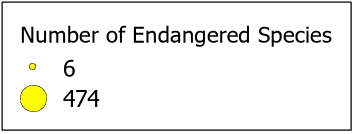
2. To show which states have the most endangered species. This includes animals and plants. Click on a yellow circle to see the exact amount per state!
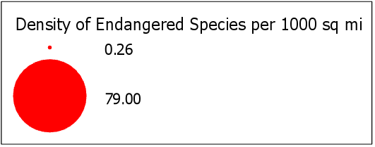
3. To show the densities of endangered species within each state (per 1000 sq mi) to compare against the quantities of endangered species.